Showing posts with label Maps. Show all posts

News---Lincoln's Strategy Map, Made Famous By Emanciaption Proclamation Portrait, Discovered

U.S. Coast Survey Civil War Map Among First to Visualize Slavery, Influence Lincoln’s Strategy, National Oceanic and Atmospheric Administration. February 10, 2011.

It isn’t often that a map visually displays a moral issue facing a divided nation and then affects a President’s response. Yet nearly 150 years ago, the U.S. Coast Survey — NOAA’s predecessor organization — produced such a map that, according to historians, President Abraham Lincoln used to coordinate military operations with his emancipation policies.

Created in September 1861, the map entitled “Map showing the distribution of the slave population of the southern states and the United States” is based on statistics from the eighth Census. It is included in NOAA’s new special collection of Civil War maps and charts, “Charting a More Perfect Union,” which contains over 400 documents gathered in one place to mark the 150th anniversary of the Civil War. “The map was among the first to use shading to represent the human population,” explains retired NOAA Corps Capt. Albert Theberge, the chief of reference for the NOAA Central Library. “It is a prime example of how Coast Survey science aided the Union cause during the Civil War.”

In addition to initiating a trend of statistical cartography, the map’s thematic display of “moral statistics” was revolutionary in affecting political change. Northern audiences were able to see that the first states to secede were those with the most slaves. Using shading to represent the human population, the darkest areas of the maps show the highest density slave populations, and the order of secession corresponds closely to the shade densities of the map. Moreover, a table in the corner of the map shows the number of slaves in each state and the proportion of slaves to the total population.

The 1860 Census was supervised by Joseph Camp Griffith Kennedy who had wanted to include slaves by name in the U.S. Census Report, but Congress refused. Alexander D. Bache was the U.S. Coast Survey superintendent at the time, and the map was created under Edwin Hergesheimer, a cartographer with U.S. Coast Survey’s drawing division.

It was Francis Bicknell Carpenter, painter of “First Reading of the Emancipation Proclamation of President Lincoln” in 1864, who first noticed that President Lincoln frequently consulted this map in considering the relationship between emancipation and military strategy. Carpenter had spent the first six months of 1864 in the White House preparing the portrait and noted that Lincoln would look at the map and send his armies to free blacks in some of the highest density areas in order to destabilize Southern order. The Emancipation Proclamation became law on Jan. 1, 1863.

The NOAA connection to the map had been lost over the decades. John Cloud, Ph.D., a historian and NOAA employee who was recovering significant Coast Survey cartographic products in NOAA’s Climate Database Modernization Program, recently discovered the connection with Hergesheimer and the U.S. Coast Survey.

The Office of Coast Survey’s “Charting a More Perfect Union” project is supported by the NOAA Preserve America Initiative — part of a federal initiative to preserve, protect and promote our nation's rich heritage. NOAA’s mission is to understand and predict changes in the Earth's environment, from the depths of the ocean to the surface of the sun, and to conserve and manage our coastal and marine resources. Visit us online at www.noaa.gov or on Facebook at www.facebook.com/usnoaagov.

Text Source: History News Network
First Image Source: National Oceanic and Atmospherical AdministrationSecond Image Source: United States Senate

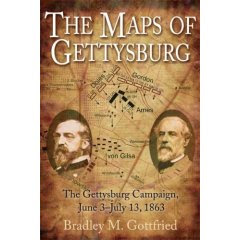
New Edition---Maps of Gettysburg 2007 vs. Maps of Gettysburg 2010

Maps of Gettysburg: An Atlas of the Gettysburg Campaign, June 3-July 13, 1863, Bradley M. Gottfried, Savas-Beatie LLC, 363 pp., 149 maps, index, bibliography, 2010, $39.95.

Maps of Gettysburg, Revised Full Color [2010] Edition, is identical in all ways to the original [2007] edition, except on the final page is a brief description of the author. Both editions' list price are $39.95. So, the obvious choice for the first time buyer is choose the Revised Full Color Edition.

So how about those colors? Red (Confederate), purple (Federal), sky blue (streams), green (vegetation), black (labels) gray (fences) and brown-gold (roads at the time of the battle). Each look great on the glossy buff colored paper. The 2007 was gray-scale on white non-glossy paper. Vegetation includes trees, corn, orchards and grains, Fences include worm, post & rail, and stone. Elevations are generalized with hash marks. The maps are scaled for distance.

Maps of Gettysburg [2010] or Phil Laino's Gettysburg Campaign Atlas [2009]? If readers are shopping for an atlas, both are equally valuable. Gottfried's is a hard cover binding and Laino's is paperbound. Gottfried's has smaller dimensions than Laino's. Gottfried's has a sturdy 'perfect' [glued] binding and Laino's has a spiral binding with thick, sturdy wire. Those who are Gettysburg Magazine readers will recognize Laino's work.

Internet buyers should use caution. It appears that many Amazon.com 'second-sellers' do not generally differentiate between the 2007 and the 2010 editions.

CWL----The National Geographics' Atlas of the Civil War

Atlas of the Civil War: A Complete Guide to the Tactics and Terrain of Battle by Stephen Hyslop, Neil Kagan, and Harris Andrews, National Geographic Incorporated, 255 pages, additional readings, index, 2009, $40.00

Comprehensive is a word of which CWL is suspicious. National Geographic's Atlas of the Civil War A Comprehensive Guide to the Tactics and Terrain of Battle is pretty close to comprehensive though.

Organized as a chronological account with eighty-five rare period maps, this atlas offers the map maker's history of the American Civil War. Campaign maps surveying whole regions and strategies, contemporary battlefield charts used by Union and Confederate generals, commercial maps produced for a newspapers are the majority of the maps in the atlas. The key moments of major battles are pinpointed by National Geographic’s cartographers using satellite data to render the terrain with astonishing detail in 35 maps created for the atlas.

In addition, there are over 300 documentary photographs, battlefield sketches, paintings, and artifacts bear eyewitness testimony to the war, history’s first to be widely captured by photography. Users of William J. Miller's Great Maps of the Civil War: Pivotal Battles and Campaigns, Earl McElfresh's Mapping For Stonewall and Maps and Mapmakers of the Civil War, the Atlas to the Official Records, the West Point Atlas of the Civil War, and the numerous online map collections of universities and libraries will be content with the depth and clarity of reproductions in this atlas. Those coming to Civil War era maps and map making for the first and second time could hardly do better that the National Geographic's atlas. Those looking for a large format nearly comprehensive book on the military aspects of the war will find in this big, handsome coffee table book to be hefty both in its weight and its contents.

CWL --- Ted Savas Clears the Air on Amazon.Com, 'Maps of Gettysburg' and the Need for a Second Printing

Ted Savas, is the director of Savas Beatie, the publishing company that just released Brad Gottfried's "Maps of Gettysburg." During the past week, he has followed the posts on Gettysburg Discussion Group.org regarding the book.

Here is his July 7th update on the issues involved:

Ordering: The book is widely available, so I do not know what Amazon is talking about when they say it won't ship for weeks. Unfortunately, Amazon went to the Big Dance with books, but left with appliances and make-up; i.e., failed to keep their book division well staffed. It is nearly impossible to get information changed on their site (it is often wrong, for many books), or get a correct answer to a simple question.

Signed and Inscribed Copies: Yes, we have signed copies atwww.savasbeatie.com. Brad was good enough to agree to sign a few cases, but they were gone in a few days. He is out of books (again), but we have ordered up more from the warehouse in DC to his home in Maryland, so orders should all be in the mail by the end of this coming week (July 13). Yes, when you order a book from us it will automatically be signed, and if you want to confirm or would like it specially inscribed, send us a follow up email through our website at sales@savasbeatie.com. We posted a recent interview with Brad there that will also answer some of the questions I am being asked.

First Editions: As I write [July 7th], about 65% of the first edition is already gone-either sold outright or in the stream of commerce. Many ask how to make sure they have a first edition, first printing. The only books out there noware first editions, first printings.

However, this week we are ordering up a second printing, which will be available in three weeks. So, you can decideon the speed with which you should act-or not. Like all books, I am sure there will be something in Gottfried's "Maps of Gettysburg" we wish we had done differently, or written differently or presented differently. It is the nature of any beast such as this.

Our sincere hope is that what we have done contributes to the study of the campaign, and that it triggers additional excitement in others whose interest is currently but lukewarm-that would be wonderful. An entry point into seeing and understanding might well do that.

I got a phone call yesterday [July 6] from a man who bought a copy at the battlefield. He had never visited the field or read about the Civil War, but his 17-year old son wanted to go. So they drove 700 miles to see the field. He said they read Brad's book in the hotel, took it on the field, and both of them "really got into the battle." Now the dad wants to read more about it, and asked for reading suggestions. That put a huge smile on my face.

Another convert infected with the virus. Finally, let take the time to say thank you for all you do on this board. Itis amazing to see the knowledge bantered so easily about here. What you have done for Gettysburg and campaign is extraordinary. I wish I could play a bigger role, but my weak knowledge base would instantly be visible for all to see. So I will stick with publishing and reading and leave the discussion to the experts. Happy reading. Best regards.

Theodore P. Savas, Savas Beatie LLC, P.O. Box 4527 El Dorado Hills, CA 95762916-941-6896 (voice)916-941-6895 (fax)

CWL --- Maps of Gettysburg: First Edition Sells Out Within the First Week and a Few Quibbles


It appears that the first edition of Maps of Gettysburg by Bradley Godfried has sold out in its first week. The publisher, Savas Beattie, is putting out a second edition that will be available in early to middle August. Current orders at Amazon.com won't be shipped until then. One reader on the Gettysburg Discussion Group reports that Barnes and Noble has 33 in the warehouse; other readers state that the Farnesworth House in Gettysburg has several and Butternut and Blue will be bringing first edition copies to the vendors exposition in Gettyburg the weekend of July 7 and 8.
Savas Beatty, the publisher, has a few of the first edition left (as of July 6th). Their phone number is 916-941-6896.

An early quibble is with the title. "Why July 13th when the last CSA forces withdrew from Falling Waters, MD on July 14th?" asks George Frank, a Gettysburg Discussion Group member.

Also, Richard Faser of the Library Journal has a few quibbles:

One specific complaint about this book should be aired before all others: its title, The Maps of Gettysburg-rather than Maps of Gettysburg-implies that the maps contained herein have some official status or particular historical significance or are recognized as definitive in some way. In fact, they are the work of Gottfried (president, College of Southern Maryland).

Well executed in black-and-white, they have no particular quality that confers special importance upon them. The author provides 144 of these maps of the Gettysburg campaign and battle, each with a single-page commentary explaining the action rendered. Regiments are depicted as black or white blocks with appropriate numbers and state abbreviations, and terrain and roads are identified.

Perhaps the greatest oversight is that while the author provides details of space, he supplies none of time. Rarely does he offer any specific information about the duration of a given phase of the battle or what time of day it took place. In his cumulative overview of this abundantly studied battle, he never achieves the clarity for which he seems to be striving. For Civil War students and enthusiasts who already know enough about the subject, this book may be handy. An optional purchase for academic libraries.

The Civil War Librarian will follow the popular reception and the scholarly reviews.
 
Bloggers Team